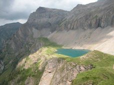
This post is for Mike Figgy and everyone else with family in Aeschi, Switzerland. Thanks Mike for your comment on our Christmas greetings post. My wife told my about your comment on the T-bar ski lift at Tschentenalp this morning and when we reached the top, I decided to take a picture of Frutigtal and Aeschi to give you a (nearly) live image of your family's village. Aeschi is marked with a read dot. Niederhorn and Sichlä (u-shape mountain pass) in the background. ...and yep, we still need a little more snow to consider it a perfect winter :)
Showing posts with label Switzerland. Show all posts
Showing posts with label Switzerland. Show all posts
Sunday, 27 December 2009
View towards Aeschi from Tschentenalp

Monday, 1 December 2008
Mystic fog over Engstligenalp, Adelboden
A few weeks ago, I shot this picture on a hike on the plateau of Engstligenalp near Adelboden. The fog was carried up by strong upward winds, the first frost and snow covered the plateau and I felt like being up in the Scottish Highlands.
Arctic impressions of Oeschinensee, Kandersteg
Hi guys,
Haven't posted anything in weeks. Sometimes I just simply don't find any nice topics to share with you. About 3 or 4 weeks ago, the first inches of snow covered the Bernese Oberland. This was the opportunity to hike up to Oeschinensee, a small mountain lake near Kandersteg. The scenery was smashing, the dark water surface was like a mirror, the reflexion of the mountains clear and sharp as I had never seen it before - have a look for yourself...
Sunday, 10 August 2008
Mountain B&B

Farm Mayen above Leysin, stayed here overnight, a marvel among alpine huts, great fondue, impressive mountain views, friendly host family, a truely alpine working farm, a comfi bed and even an espresso machine. smashing!
How to get there: Take public transport to the Ski resort of Leysin, VD. Then either hike up to Refuge de Mayen or rent a mountain bike (great and very well marked mtb trails!). For the more convenient traveller, there is a lift up to Mt. Berneuse (Leysin panoramic restaurant), from there it is a short hike downhill to farm Mayen.
Thursday, 3 January 2008
Meiringen-Hasliberg

Sometimes one should not write too much, it would only spoil the image... enjoy - sorry for the poor quality, I took this pic with my mobile. Location: View on Lake Brienz (in fog) from Meiringen-Hasliberg, Alpine Tower Ski Region, Bernese Oberland, Switzerland.
Friday, 16 November 2007
Snow! Snow! Snow! Ski resorts open early this year
Great news for winter sport enthusiasts. This week's snow fall enables most major ski resorts in Switzerland to open their ski lifts early. In the Bernese Oberland, Elsigenalp (Frutigen) start their season today. Don't ask me, why I have decided to go to work this morning, I don't know and mistakes happen :-)
Berner Zeitung (local newspaper) annouce that tomorrow, Saturday, November 17, 2007, 55 lifts and 145 kilometers will be open in the Bernese Alps, among them are Meiringen-Hasliberg, Grindelwald, Wengen-Kleine Scheidegg, Mürren, Grimmialp, Lenk, Jaunpass and Gstaad-Saanen. But check the local snow/lift reports before you choice a resort, most of them still operate only during the weekend and/or with a limited number of lifts.
Wednesday, 31 October 2007
Mürren, a gem among Swiss Alpine villages

The village of Mürren may not exactly be considered an off-the-beaten-track destination. Its spectacular location at the edge of an impressive vertical rock face sourrounded by glacial mountains, enthroned by Schilthorn (peak at 2’970 metres above sea) make this village a well-visited tourist attraction of the Bernese Oberland. Yet, the remoteness of the village and the fact, that it can only be reached by either a mountain railway or a cable car prevent the village from being overrun by mass tourism and with this preserve traditional charm laying over the Alpine chalets.
Image above shows view from Mürren village towards Eiger (left).
Sunday, 23 September 2007
Gehrihorn

Sunday, 24 SEP 2007 @ 12.27 live - stunning view... and Bernese alps in the back :)
Post-hike addendum: Here a nice 5-hour hike from Kiental, Bernese Oberland. From Kiental village take the chairlift to Ramslauenen (restaurant), then follow the well-marked footpath to Gehrihorn. The ascent takes about 1.5 to 2 hours and is quite tough. Once you reach the ridge the view is simply magnifisant. To the South you face the Bernese Alps including the peaks of Eiger, Monch and Junfrau and several other snow-covered giants. Frutigtal (valley), Lake Thun and Emmental spread in front of you in the North. After a lunch break on Gehrihorn (2'130 metres above sealevel) follow the ridge to Grathütte (attended alpine hut, light snacks and accommodation available) before heading downwards to your starting point at Ramslauenen again. As there are a few short but tricky passages just after Gehrihorn, check the weather forecast beforehand. Kiental can be reached by a public bus service from Reichenbach (train station).
Sunday, 9 September 2007
Trift Bridge between Susten and Grimsel

Just a quick update, a few days have past without any news, sorry for that. I've been quite busy enjoying the last warm summer days. But now that fall arrives I will probably have more time in front of my computer again.
Anyway, two weeks ago Sue and Philipp joined me on an easy walk to Trift Brücke (trift bridge), a spectacular rope bridge over a canyon formed by the Trift glacier (Bernese Oberland, Switzerland). If you use Interlaken as your gateway, drive to Innerkirchen, then follow Susten. After a few kilometers up towards the mountain pass, you will come across a small cable car station. The cable car is run by the company in charge of the water power station in the region. Take the small gondola that runs every 10 minutes to the top. From there, a well marked trail leads up to the bridge (walking time approx. 1.5 hours). The path is somewhat steep and people who are not used to the mountains may find it a bit exposed in some parts. The scenery from the Trift bridge is supurb! Look down into a natural bowl sourrounded by mountains, a glacier lake and the permanent ice in the back.
Anyway, two weeks ago Sue and Philipp joined me on an easy walk to Trift Brücke (trift bridge), a spectacular rope bridge over a canyon formed by the Trift glacier (Bernese Oberland, Switzerland). If you use Interlaken as your gateway, drive to Innerkirchen, then follow Susten. After a few kilometers up towards the mountain pass, you will come across a small cable car station. The cable car is run by the company in charge of the water power station in the region. Take the small gondola that runs every 10 minutes to the top. From there, a well marked trail leads up to the bridge (walking time approx. 1.5 hours). The path is somewhat steep and people who are not used to the mountains may find it a bit exposed in some parts. The scenery from the Trift bridge is supurb! Look down into a natural bowl sourrounded by mountains, a glacier lake and the permanent ice in the back.
Friday, 17 August 2007
Prestine mountain symphony
Time flies. Half a month has past without any new outdoor recommendations, my apologies. Well, tonight I have gone through some of my albums on my computer. What I have come across is simply beautiful. Let me share these images with you. This first image shows Lac de Salafe (Lake Salafe) and Les Dents du Midi (mountain range) near Martigny, Switzerland. I took this shot during a two-day hike about 2 years ago.
This pic was taken just before sunrise during a hike to Morgenberghorn. It shows Lake Thun and sleepy Interlaken covered in the early morning fog. Moments like this one just blow me away. Even though I live here, it seems that I can't get enough. What can I say, I am an outdoor lunatic ;-)
Saturday, 28 July 2007
Tropfloch Caves

After an unsuccessful first attempt to locate the Tropfloch caves a few weeks ago (see post of June 6, Little Scandinavia), we have returned to this fairytale region south of 'Sieben Hengste' (seven stallions'ridge) near Habkern, Bernese Oberland. Now, with the snow gone, it was much easier to reach the caves. Right now we are sitting around the fire enjoying the evening in the woods half way down. To all those who prefer a smokey evening in front of a fire to a snobby prosecco party, enjoy your evening!
Tuesday, 24 July 2007
Sentiero Alpino Calanca - that 4-day ridge hike amost made me go mad
As promised here the details on Sentiero Alpino Calanca, a tough 3- to 4-day mountain hike in the South East of Switzerland. I loved the astonishing view (just click on the album and you'll know what I mean), I enjoyed the unspoilt nature of these mountains but let me tell you, some of the more exposed passages made my knees feel like jelly. One must be mad to build a one-foot wide hiking trail into a 3'000ft vertical wall with no chains or security ropes. Mad, and I almost feaked out. I was seriously considering calling a helicopter to get me out of it. Thanks god, my dear travel companion turned out to be a mountain goat with the talent to calm the atmosphere. Thanks Sue!
 |
| Sentiero Alpino Calanca |
For all those experienced mountain hikers, who feel capable of some really tricky parts: Trailhead is San Bernardino Moutain Pass (between Belinzona and Chur, Switzerland, easily accessable by public buses). 1st day: San Bernardino - Refugio Pian Gran (self-catering), 2nd day: Pian Gran - Bivak Ganan (self-catering), 3rd day: Ganan - Cabanna Buffalora (catered mountain cottage). Reservations for all 3 locations recommended, more details on: http://www.sentiero-calanca.ch/ (official website of ASAC, the trail management association)
Wednesday, 18 July 2007
Heart-shaped lake
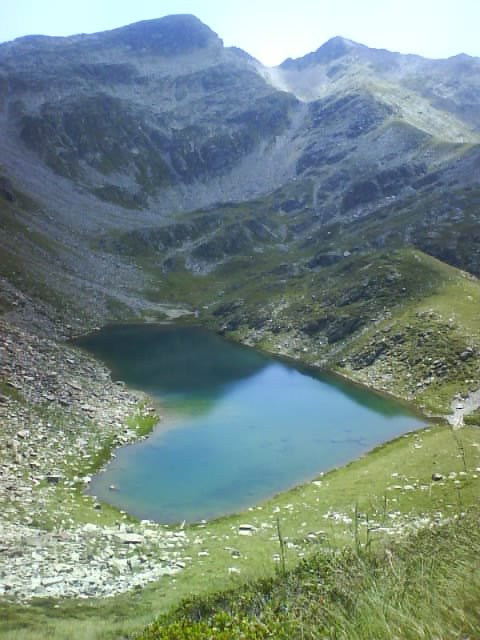
Currently on Sentiero Alpino Calanca, day 3, just arrived in the cosy log cabin of Buffalora after lunch at this freezing cold mountain lake. Ciao from the Southern Swiss Alps.
Sunday, 8 July 2007
Saustal, a hidden valley
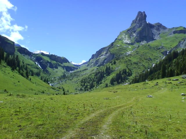
Here a short hike to a nice alpine farming valley near Interlaken. Grab a coffee, take the train from Interlaken Ost to Lauterbrunnen and don't get to stressed by what may look like a tourist trap to you (...just focus on your coffee). Most of these tourists aim for Wengen, Kleine Scheidegg and Jungfrau. You get off at Lauterbrunnen, cross the street and hop on the cable car to Grütschalp (1486 m, 4379 ft). Unlike everyone else, don't board the train to Mürren now. Walk around out off the station and you will find markers at the trail head. From here, it's one hour and 20 minutes to the Saustal, you can't miss it. In the valley you will find a few alpine huts (seasonal farming) and some of them offer mountain cheese and other local products. Well and the scenery, it may not be as breathtaking as Eiger, Monch and Jungfrau but hey, you only share the view with two or three local farmers and some cows. ...and no(!) they don't have Starbucks up here and yes, you are better off bringing your hiking boots rather than flipflops.
Sunday, 1 July 2007
Stockental bike playground
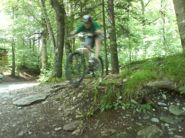
You won't find this area on any trail map. It is not exactly one specific trail either. Stockental (Stocken Valley) is approx. 10 kilometres from either Thun or Spiez. I recommend buying a 1:25'000 scale map of "Thun". On there you will notice quite a lot of gravel trails along the first mountain range. There are simply to many tracks to point out a major one.
Saturday, 30 June 2007
Kayaking on Lake Thun
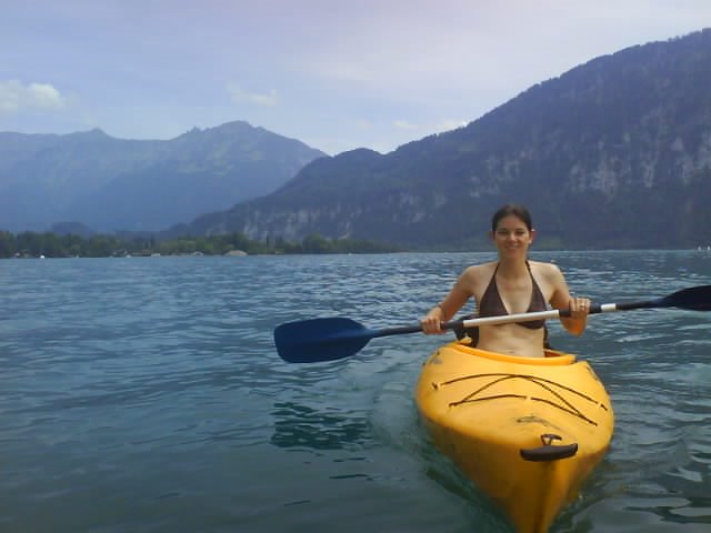
It can't just be hiking and biking all the time. Like today, with temperatures around 30 degrees Celsius (86 Fahrenheit) and a humidity similar to a steam room, we suggest a less strenous activity. How about renting a kayak or canoe on Lake Thun. Your ideal starting point could be Neuhaus camp site near Interlaken. Other activities such as wakeboarding, wind surfing, paragliding are also available.
Oh and one other thing. Once on the lake with your kayak, watch out for the larger passenger boats. Their wakes are fun but don't try to demonstrate that you are a superhero.
Sunday, 24 June 2007
BBQ mountain bike combo
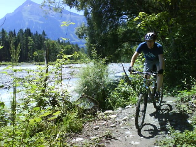
Here a lazy option for a hot summer day (...or romantic evening). Along the rivers Kander (between Kandersteg-Thun), Simme (between Boltigen-Wimmis) and Aare (between Thun-Bern) you find plenty of cosy spots to grill a few sausages and enjoy a few drinks. Personally, I like the area, where Simme and Kander meet. Not only can you get there following a lovely single trail, but it is also wild area reminding me of Canadian wilderness. Ideal for a BBQ bike lover's combo.
You will always find enough wood to make a decent fire. The rivers are quite rough and cold, so if you fancy swimming, I would recommend Aare or Lake Thun.
Tuesday, 12 June 2007
Weather forecast or trouble - you choose

The current weather situation here is, ehm... say quite as fragile as an egg thrown against solid rock. And that reminds me of 3 mad hikers I met last year when I took this pic high above Lenk, Simmental (Bernese Oberland). It was 4pm and either time to find a try spot in the nearby shelter or maybe the last chance to head for the village. And guess what. The 3 hikers, a German daddy and his two teenage sons, were heading in the other direction. They intended to climb Wildstrubel, a serious mountain, hard enough in good weather conditions. I tried to stop 'em but they wouldn't listen. And believe me, the night was bad enough. They too, must remember that hike :-)
Wednesday, 6 June 2007
Little Scandinavia
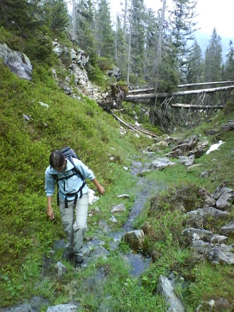
Here an impression of the woods of Grünenbergpass above Habkern (close to Interlaken). An area not known to many tourists and yet a hiker's dream within easy reach from Interlaken. Unfortunately, rain and snow had turned the path into a swampy wet-feet trail last Sunday. But hey, that's nature.
Friday, 1 June 2007
Weekend trip with glacier crossing

Here's another idea for a sunny summer weekend (not recommended before mid June or after October, depending on snowfall): from Adelboden, Bernese Oberland, hike to Engstligenalp or take the cablecar as a shortcut. Then, you can enjoy splendid views hiking along Kindbettipass to Lämmerenhütte (SAC alpine hut, reservation recommended). On the way, you gotta cross a small, but impressive glacier. Mind the gaps! The scenery is amazing and diverse, from grasslands through rugged rocky parts to high Alpine stone deserts and year-round ice. The second starts with crossing a dreamy wide mountain valley with little creeks before hitting the popular hiking trail from Gemmi to Kandersteg. As on the first day, you can once again take the fb (fat bastard's) lazy option from Sunnbühl to Kandersteg or walk down along the beautiful waterfall. We loved it and hope you will enjoy it too!
Subscribe to:
Posts (Atom)